One method people use to identify their position is by looking at the latitude. These imaginary lines form circles around the Earth and run parallel to the Equator. The latitude of a place is defined as the angle between a line drawn from the center of the Earth to that point and the equatorial plane. For any point in the Northern Hemisphere, a navigator can measure their latitude by determining the angle that Hōkūpaʻa (also known as Kūmau, Wuliwulifasmughet, Fuesemagut, North Star, or Polaris) makes with the horizon.
During voyages, knowing the correct angles can make the difference between reaching our destination or missing it. Navigators carefully observe angles on the Hawaiian Star Compass to determine the entry and exit points of celestial bodies in the sky, as well as the direction of wind and current. In this section, we will explore the properties of angles and their measure.
Definition1.2.1.
A ray is a part of a line that begins at a point and extends in one direction.
Definition1.2.2.
We can create an angle, , by rotating rays. First, we begin with two rays lying on top of each other and beginning at . We let one ray be fixed and will rotate the second ray about the point . The ray that is fixed is called the initial side and the ray that is rotated is called the terminal side.
Remark1.2.3.
Angles are often measured using Greek letters. The commonly used Greek letters include ,,,, and .
Subsection1.2.1Degree
The measure of an angle is the amount of rotation from the initial side to the terminal side. One unit of measuring angles is the degree. One degree, denoted by , is of a complete circular revolution, so one full revolution is .
The Hawaiian Star Compass consists of 32 houses, each spanning (). Assuming due East corresponds to and the center of the House of Hikina points due East, the border between Hikina and Lā Koʻolau will be half the angle of the house, (). The angles for the other boundaries on the Hawaiian Star Compass are shown in Figure 1.2.4.
Figure1.2.4.The Star Compass with the angles indicating the boundaries for each house.
Although decimals are commonly used to represent fractional parts of a degree, traditionally, degrees were represented in minutes and seconds. One minute or arc minute, denoted as , is equal to degrees, and one second or arc second, denoted as , is equal to minutes.
Remark1.2.5.Conversion Between Degree, Minutes, and Seconds.
Example1.2.6.Convert an angle from decimal degrees to degrees/minutes/seconds.
In the Star Compass (Figure 1.2.4), the angle between the houses Manu Hoʻolua (northwest) and Noio Hoʻolua (northwest by west) measures . Represent this angle in degrees, minutes, and seconds.
Solution.
First we will convert to minutes using the conversion ,
.
Since , we can convert to seconds: .
So .
Example1.2.7.Convert an angle from degrees/minutes/seconds to decimal degrees.
Convert to decimal degrees.
Solution.
We will first convert and to degrees.
and
.
So .
Definition1.2.8.
If an angle is drawn on the -plane, and the vertex is at the origin, and the initial side is on the positive -axis, then that angle is said to be in standard position. If the angle is measured in a counterclockwise rotation, the angle is said to be a positive angle, and if the angle is measured in a clockwise rotation, the angle is said to be a negative angle.
Definition1.2.9.
When an angle is in standard position, the terminal side will either lie in a quadrant or it will lie on the -axis or -axis. An angle is called a quadrantal angle if the terminal side lies on -axis or -axis. The two axes divide the plane into four quadrants. In the Cartesian plane, the four quadrants are Quadrant I, II, III, and IV. The corresponding quadrants of Star Compass are Koʻolau (NE), Hoʻolua (NW), Kona (SE), and Malanai (SW).
Definition1.2.10.
Coterminal angles are angles in standard position that have the same initial side and the same terminal side. Any angle has infinitely many coterminal angles because each time we add or subtract from it, the resulting angle has the same terminal side.
Example1.2.11.Coterminal angles.
and are coterminal angles since .
To determine the quadrant in which an angle lies, we add or subtract one revolution () until we obtain a coterminal angle between and . The quadrant where the terminal side lies is the quadrant of the angle. Quadrantal angles do not lie in any quadrant.
Example1.2.12.Determine the corresponding house and quadrant in the Star Compass.
Determine the quadrant in which each angle lies and name the corresponding house and quadrant in the Star Compass (Figure 1.2.4).
(a)
Solution.
Since , lies in Quadrant II, or Manu Hoʻolua.
(b)
Solution.
Since , we first add to to obtain an angle and ,
.
So and are coterminal. Since , lies in Quadrant IV, or Manu Malanai.
(c)
Solution.
Since we begin by subtracting
.
So and are coterminal. Since , lies in Quadrant III or ʻĀina Kona.
Example1.2.13.Determine the corresponding quadrant given its location in the Star Compass.
What is the corresponding quadrant for Nālani Kona?
Solution.
Locating Nālani Kona in the Star Compass, we see it is in Quadrant III.
Definition1.2.14.
A central angle is an angle formed at the center of a circle by two radii.
Remark1.2.15.Heading and Azimuth.
In navigation, the direction a waʻa is pointed towards is referred to as the heading. Unlike in trigonometry, where it is conventional to define an angle in standard position, with lying along the positive -axis, in navigation, North corresponds to a heading of and positive angles are measured in a clockwise rotation (see Figure 1.2.16).
Figure1.2.16.The cardinal directions for headings are as follows: (or ) points north, points east, points south, and points west.
The Star Compass can now be presented in terms of heading angles, as demonstrated in Figure 1.2.17.
Figure1.2.17.The Star Compass is presented in terms of heading, with the angles indicating the boundaries for each house.
In astronomy and navigation, the azimuth and altitude are used to determine the position of celestial bodies relative to the observer’s location. The azimuth refers to the angular measurement of the direction of a celestial body, typically measured from north and increasing clockwise along the horizon. The altitude of a celestial body is its angle above the horizon, measured in degrees. The zenith is the point directly overhead an observer, and a celestial body located at the zenith has an altitude of . See Figure 1.2.18.
In navigation, “heading” typically refers to the direction in which an object, such as a canoe or wind, is pointed. In contrast, “azimuth” pertains to the angular measurement of celestial bodies relative to the horizon. Both “heading” and “azimuth” measure angles in degrees, starting from north and progressing clockwise. Unless specified otherwise, this book uses Figure 1.2.4 for the angles of the Star Compass; for heading or azimuth angles, refer to Figure 1.2.17.
Figure1.2.18.The azimuth is the angle measured along the horizon from north to the star’s projection, and the altitude is the angle from the horizon up to the star. Together, these angles determine the star’s location relative to the observer.
Subsection1.2.2Radian
Another way to measure an angle is with radians, which measure the arc of a circle that is formed from an angle.
Definition1.2.19.Definition of a Radian.
The radian measure of a central angle in a circle is the ratio of the length of the arc on the circle subtended by the angle to the radius. If is the radius of the circle, is the angle, and is the arc length, then we have the following
.
A radian is abbreviated by rad.
The measure of a central angle obtained when the length of the arc is also equal to the radius, , is called one radian (1 rad). Similarly, if rad, then the arc length equals .
The circumference of a circle is . This means that the circumference is times the radius. Consequently, if we were to use a string of length equal to the radius, we would need six such strings plus a fractional piece of the string, as shown in Figure 1.2.20.
Figure1.2.20.One rotation of the unit circle is radians.
Remark1.2.21.Relationships Between Degrees and Radians.
If a circle with radius 1 is drawn, it has , and the full arc length is the circumference, which is . Therefore,the relationship between degrees and radians is:
radianor radian
radian,
radian.
Remark1.2.22.Converting Between Degrees and Radians.
To convert degrees to radians, multiply by radians or radian
To convert radians to degrees, multiply by radians or radian
Example1.2.23.
Express in radians.
Solution.
radians radians
Example1.2.24.
Express in degrees.
Solution.
radrad rad
Using this method, we obtain Table 1.2.25 of common angles used in trigonometry and the corresponding radian and degree measures.
Table1.2.25.Commonly Used Angles in Trigonometry: Degrees and Radians.
Radians
0
Degrees
Radians
Degrees
Subsection1.2.3Arc Length
Recall that the definition of a radian is the ratio of the arc length to the radius of a circle, . By rearranging this formula, we can obtain a formula for the arc length of a circle.
Theorem1.2.26.
In a circle of radius , the arc length, , subtended by a central angle (in radians), , is
.
If is given in degrees, then .
Example1.2.27.
Find the length of an arc of a circle with radius 10 cm subtended by an angle of radians.
Solution.
Using the arc length formula we get cmradcm.
Example1.2.28.
Kiritimati, also known as Christmas Island, is an atoll in the Republic of Kiribati. Kiritimati’s location west of the International Date Line makes it one of the first places in the world to welcome the New Year, while Hawaiʻi is one of the last places. Although Kiritimati and Molokaʻi share the same longitude at west (meaning Molokaʻi is directly north of Kiritimati), both islands are 24 hours apart. For example, if the time on Molokaʻi is 3:00 pm on Thursday, then at that same moment it is 3:00 pm on Friday in Kiritimati. Find the distance between Kiritimati ( north latitude) and Molokaʻi ( north latitude). Assume the radius of Earth is 3,960 miles and that the central angle between the two islands is the difference in their laititudes.
Solution.
The measure of the central angle between the two islands is
.
To find the distance, we use Theorem 1.2.26 to find the arc length:
miles miles.
So the distance between Kiritimati and Molokaʻi is approximately 1,340 miles.
Subsection1.2.4Area of a Sector of a Circle
Definition1.2.29.Area of a Sector.
The area of the sector of a circle of radius formed by a central angle of is
when is in degrees when is in radians.
Notice the ratio is the proportion of the angle (in degrees) to one complete circle. Additionally, the circumference of a circle is given by . Therefore, the arc length is simply the proportion of the central angle to the whole circle multiplied by the circumference of the circle.
arc length(proportion of circle)(circumference)
Similarly, the area of a circle is given by . So the area of a sector is the proportion of the central angle to the whole circle multiplied by the area of the circle.
area of sector(proportion of circle)(area of circle)
Theorem1.2.30.
Given a circle of radius and a central angle , the arc length and area of the sector formed by can be expressed as the proportion of the angle to the full circle multiplied by the circumference and area of the circle, respectively.
(proportion of circle)(circumference)
and
(proportion of circle)(area of circle).
Example1.2.31.
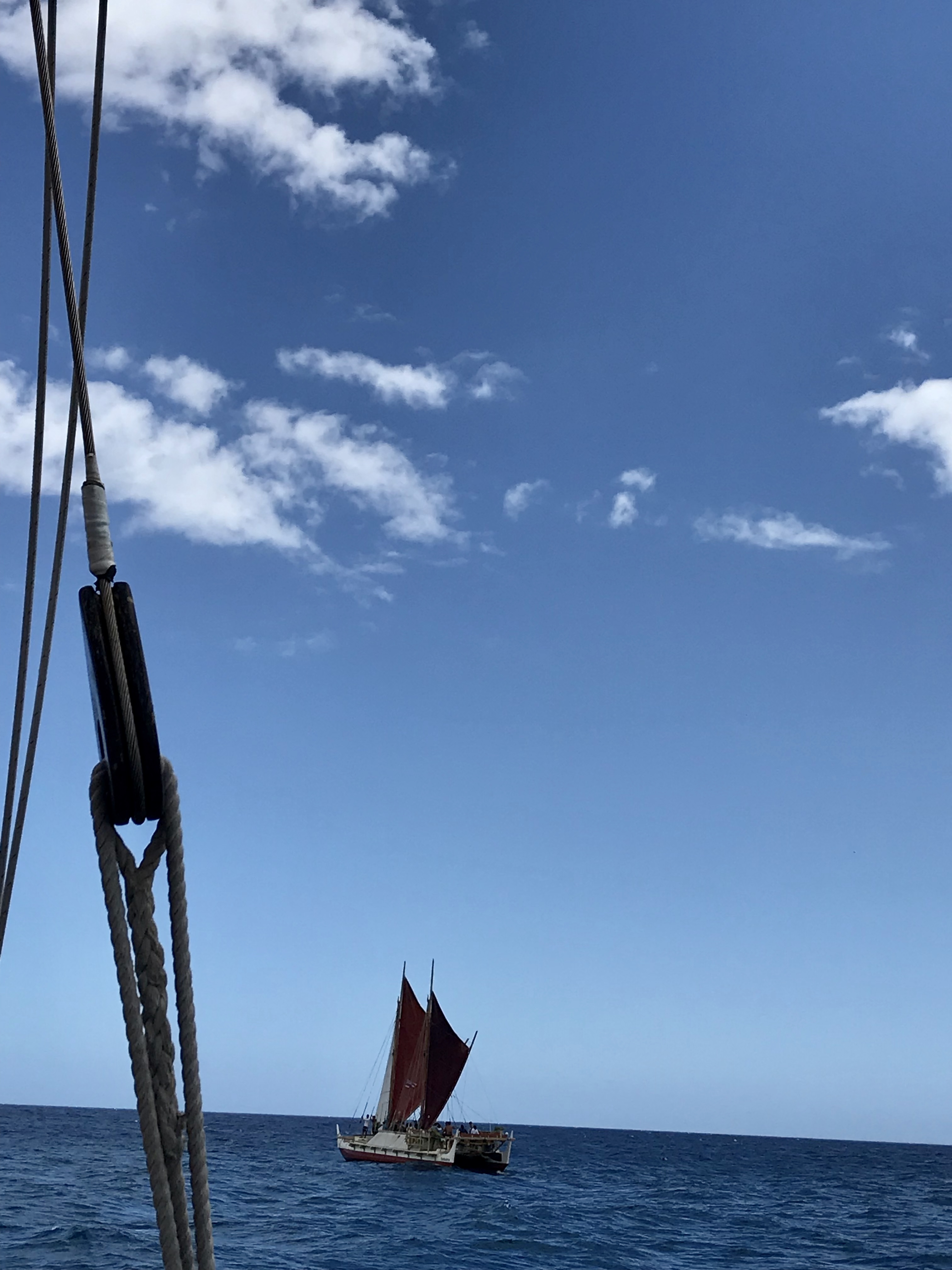
When sailing, the waʻa Hōkūleʻa cannot make headway by sailing directly into the wind. She can only sail beyond in either direction from the wind (Figure 1.2.32). If Hōkūleʻa sails 50 miles, what is the area of the sector that cannot be sailed? Round your answer to the nearest square mile.
Figure1.2.32.Hōkūleʻa cannot sail within into the direction of the wind.
Solution.
The angle is and the radius is miles. So the area is given by
square miles.
Subsection1.2.5Angular Velocity and Linear Speed
Consider an object moving along a circle as shown below. There are two ways to describe the circular motion of this object: linear speed which measures the distance traveled; and angular speed which measures the rate at which the central angle changes.
Definition1.2.33.Linear Speed.
Suppose an object moves along a circle with radius , and let (measured in radians) be the angle traversed in time . Let be the distance the object traveled in time . Then the linear speed, , of the object is given by
.
Definition1.2.34.Angular Speed.
Suppose an object moves along a circle. Let (measured in radians) be the angle traversed by the object in time . The angular speed, , of the object is given by
.
Notice that we can rearrange the angular speed to get . Since is an arc length, we have , and thus we can write the linear speed as
.
Definition1.2.35.Linear Speed.
Suppose an object moves along a circle with radius and an angular speed (measured in radians per unit time). Then the linear speed, , of the object is given by
.
Example1.2.36.Une.
One method a waʻa uses to change direction is with the hoe uli, or the steering paddle. When a sharp turn is needed for maneuvers such as tacking, the steersperson will turn the handle of the hoe uli in a circular motion, as a lever to scoop the paddle in the water and change the heading of a vessel. This move, called une (pronounced “oo-neh,” though it is often mispronounced as “oo-nee”), literally translates to “lever.”
Figure1.2.37.A waʻa (canoe) can change directions by rotating the hoe uli (steering sweep) in a process known as une. If you are viewing the PDF or a printed copy, you can scan the QR code or follow the “Standalone” link to watch the video online.
If the steerperson is performing an une at a rate of 25 rotations per minute and the radius of the circular movement is 2 feet, calculate:
(a)
The angular speed measured in radians per minute.
Solution.
We are given that the angular speed is revolutions per minute. To convert our angular speed to radians per minute, we use the fact that one revolution is radians to get
Thus the hoe uli is moving at an angular speed of radians per minute.
(b)
The linear speed of the hoe uli in miles per hour (round your answer to two decimal places).
Solution.
Since the radius is ft and the angular speed is radians per minute, we can use Definition 1.2.35 to calculate the linear speed
ftradiansminmileftminhrmileshour.
Thus the steersperson is moving the hoe uli at a linear speed of 3.57 mph.
Exercises1.2.6Exercises
Exercise Group.
Given an angle, , identify the house and quadrant on the Hawaiian Star Compass.
1.
Answer.
ʻĀina Malanai
2.
Answer.
Nālani Kona
3.
Answer.
Noio Koʻolau
4.
Answer.
Manu Kona
5.
Answer.
Nā Leo Hoʻolua
6.
Answer.
Lā Kona
7.
Answer.
Noio Malanai
8.
Answer.
ʻĀina Hoʻolua
9.
Answer.
Lā Hoʻolua
Exercise Group.
Convert the given angle to a decimal in degrees rounded to two decimal places.
10.
Answer.
11.
Answer.
12.
Answer.
13.
Answer.
14.
Answer.
15.
Answer.
16.
Answer.
17.
Answer.
18.
Answer.
19.
Sirius, the brightest star in the night sky, has been known by various names in different cultures and languages around the world. In Tahiti, it is called Taurere and is considered a zenith star as it passes directly overhead. Taurere has a declination of , representing its angular distance south of the celestial equator. Express Taurere’s declination as a decimal rounded to two decimal places.
Answer.
Exercise Group.
Recall the Star Compass with the boundaries for each House. Write the angles for the boundaries between the following houses in the Koʻolau quadrant in terms of degrees, minutes, and seconds.
20.
Between Hikina and Lā ()
Answer.
21.
Between Lā and ʻĀina ()
Answer.
22.
Between ʻĀina and Noio ()
Answer.
23.
Between Noio and Manu ()
Answer.
Exercise Group.
Convert the given angle to degrees/minutes/seconds rounded to the nearest second and identify the house and quadrant on the Hawaiian Star Compass.
24.
Answer.
Haka Kona
25.
Answer.
Noio Kona
26.
Answer.
Nā Leo Kona
27.
Answer.
ʻĀkau
28.
Answer.
Manu Hoʻolua
29.
Answer.
ʻĀina Hoʻolua
30.
Answer.
Noio Malanai
31.
Answer.
Manu Koʻolau
32.
Answer.
Nā Lani Kona
Exercise Group.
Convert the given angle to radians, and identify the house and quadrant on the Hawaiian Star Compass. Express your answers in terms of .
33.
Answer.
Haka Hoʻolua
34.
Answer.
ʻĀkau
35.
Answer.
Lā Kona
36.
Answer.
Nālani Hoʻolua
37.
Answer.
Noio Koʻolau
38.
Answer.
Nālani Kona
39.
Answer.
Haka Koʻolau
40.
Answer.
Manu Kona
41.
Answer.
ʻĀina Malanai
Exercise Group.
Draw the angle in standard position.
42.
Answer.
43.
Answer.
44.
Answer.
45.
Answer.
46.
Answer.
47.
Answer.
48.
Answer.
49.
Answer.
50.
Answer.
51.
Answer.
52.
Answer.
53.
Answer.
Exercise Group.
Convert the given angle from degrees to radians. Round your answer to two decimal places.
54.
Answer.
55.
Answer.
56.
Answer.
57.
Answer.
58.
Answer.
59.
Answer.
Exercise Group.
Convert the given angle from radians to degrees. Round your answer to two decimal places.
60.
Answer.
61.
Answer.
62.
Answer.
63.
Answer.
64.
Answer.
65.
Answer.
Exercise Group.
Determine whether the two given angles in standard position are coterminal.
66.
,
Answer.
Yes
67.
,
Answer.
No
68.
,
Answer.
Yes
69.
,
Answer.
Yes
70.
,
Answer.
No
71.
,
Answer.
Yes
Exercise Group.
Find an angle between and that is coterminal with the given angle.
72.
Answer.
73.
Answer.
74.
Answer.
75.
Answer.
76.
Answer.
77.
Answer.
Exercise Group.
Given a circle with radius , calculate (a) the length of the arc subtended by a central angle ; and (b) the area of a sector with central angle . Round your answer to four decimal places.
78.
in,
Answer.
in;
in
79.
m,
Answer.
m;
m
80.
mi, radians
Answer.
mi;
mi
81.
cm, radians
Answer.
cm;
cm
Exercise Group.
At the start of this section, we learned that the latitude of a place is the angle between a line drawn from the center of the earth to that point and the equatorial plane. If the radius of the Earth is 3,959 miles, calculate the arc length, , along the surface of the earth for each value of .
82.
of latitude (in miles, rounded to 2 decimals).
Answer.
miles
83.
of latitude (in miles, rounded to 2 decimals). A nautical mile, frequently used in navigation, is slightly longer than a mile on land. One nautical mile was historically defined to be the arc length corresponding to one minute of latitude. Compare your result with the accepted value of one nautical mile.
Answer.
miles
84.
of latitude (in feet, rounded to the nearest integer). Note that 1 mile is equivalent to 5,280 feet.
Answer.
feet
85.
The oeoe, or Hawaiian bullroarer, is made by drilling holes into a kamani seed or coconut shell, then threading a long string through the holes to secure it. When the oeoe is swung by the string, a whistling sound is produced, similar to the sound of the wind on the top of mountains. If a girl is swinging an oeoe at the end of 3 foot long rope at a rate of 180 revolutions per minute, calculate:
(a)
The angular speed measured in radians per minute.
Answer.
radians/minute
(b)
The linear speed of the shell in miles per hour (round to two decimal places).
Answer.
miles/hour
86.
The Earth completes one revolution around the Sun approximately every 365.25 days. We will assume the orbit is a circle, and that the Earth is million miles from the Sun.
(a)
How far does the Earth travel in one day, expressed as millions of miles?
Hint.
First determine the angle or proportion of a revolution that Earth travels in one day, then calculate the arc length of Earth’s orbit.
Answer.
million miles
(b)
How for does the Earth travel in 30 days, expressed as millions of miles?
Answer.
million miles
(c)
How far does the Earth travel in one revolution around the sun, expressed as millions of miles?
Answer.
million miles
(d)
What is the linear speed of Earth as it orbits the Sun? Express your answer in miles per hour.
Answer.
miles per hour
87.
As the moon orbits the Earth, different parts of its surface become illuminated by the Sun, which we call moon phases. The moon completes one revolution about the Earth in approximately 27.3 days. If we assume its orbit is circular and the moon is 239,000 miles from Earth, calculate the linear speed of the moon, expressed as miles per hour.
Answer.
2,292 miles per hour
88.
At S latitude, the city of Nadi, Fiji is km from the Earth’s axis of rotation. In 24 hours, Nadi will have traveled one revolution around Earth or km. The city of Port Vila, Vanuatu lies 967 km directly to the west of Nadi, Fiji. As the Earth rotates, how many minutes sooner will the people in Nadi see the Sun rise than the people in Port Vila, rounded to one decimal?
Hint.
The proportion of distance between the two cities to the distance traveled in one rotation is the same as the proportion of the time it takes to see the sun between the two cities to time it takes to complete one revolution.
Answer.
36.5 minutes
89.
In Example 1.2.31, we learned that wa‘a cannot sail directly into the wind. For each of the following canoes and distance traveled, determine the area of the sector that cannot be sailed? Recall that 1 house = . Round your answer to the nearest square mile.
(a)
Makaliʻi sails for 25 miles and cannot sail within 4 houses from the direction of the wind.
Answer.
square miles
(b)
Alingano Maisu sails for 15 miles and cannot sail within 3 houses from the direction of the wind.
Answer.
square miles
90.Navigating by the Sun: Using Solar Declination and Rising Sun to Orient on a Canoe.
The position of the rising or setting sun changes throughout the year. Solar declination (denoted as ) is the angle between the direction where the Sun rises (or sets) and due east (or due west) on the horizon. It represents how far north or south the Sun is from the celestial equator, projected onto the Earth’s equatorial plane. Solar declinations to the north are positive, while those to the south are negative. At the Equinoxes (around March 20th and September 22nd), the solar declination is (), as the Sun is directly above the equator. During the December solstice, around December 22, the Sun rises from its most southern position, 23.5 degrees south of due east (), and during the June solstice, around June 22, the Sun rises from its most northern position, 23.5 degrees north of due east ().
A navigator can use their knowledge of the rising sun to help orient themselves. For example, on May 22, the solar declination is . If the navigator identifies where the Sun rises on the horizon during the Equinox, she can measure south of that point to identify East and then orient herself accordingly.
(a)
What is the azimuth of the Sun on May 22? Remember, the azimuth is the angular measurement from North, measuredclockwise.
Answer.
(b)
What house is the sun rising in?
Answer.
ʻĀina Koʻolau
(c)
What house does the sun set in?
Hint.
Celestial bodies rise and set in the same house but different quadrants.
Answer.
ʻĀina Hoʻolua
(d)
If the canoe is sailing with the rising sun on the port side (the left side of the canoe when facing forward), and the navigator measures the angle between the direction of the canoe and the sun as , what is the heading of the canoe? Recall that heading is the angle measured clockwise from North.
Answer.
(e)
What house is the canoe sailing in?
Answer.
Nā Leo Malanai
91.
Swells are one of the most consistent navigational tools used to keep on a course because they can remain constant over time. On 27 May 2023, while sailing on the vaka Paikea from Rarotonga to Apia, you finished your watch (your assigned shift) and are ready to take a nap. Before you lie down, you take note that the canoe has a heading of and the swells are coming from the southwest (Manu Kona) and hitting the canoe at above directly left of the canoe.
(a)
What is the heading of the swell?
Answer.
(b)
When you wake, you noticed the swells are now hitting the canoe from to the left of your heading. You are aware that the swells could not have changed this fast and conclude that while you were asleep, the canoe changed its heading. Assuming the swell was constant, determine your new heading.
Answer.
92.
After spending six weeks in Samoa, vaka Paikea is making his way back from Apia to Rarotonga. On July 14, 2023, the canoe is sailing with a heading of , and the wind is coming to the canoe from to the right of the heading. What is the heading and house from which the wind is coming?